Home
Tides
Tide Streams
Weather
Inshore Waters Forecast
Where to paddle
North Down
>
Holywood
Crawfordsburn
Bangor
Groomsport
Donaghadee
Millisle
Ballyhalbert
South Down
>
Ballyhornan
Killough
Newcastle
Strangford Lough
>
Cunningburn
Killyleagh
Island Reagh
Nendrum Monastery
Whiterock
Portaferry
Delamont
Kircubbin
Islands Strangford Lough
River Lagan
>
Ravenhill Reach
Shaw’s Bridge
Minnowburn
River Lagan Photos
Quoile River
Map of Down
Canoe Trails
Safety
Kayak Safety
Sea Canoe/Kayak Safety
Emergency Numbers
In an Emergency
After Dark
>
Navigation Lights
Sunrise Sunset times
Hazard Map
Buy Rent & Centres
Contact Us
About Us
The Seaside Code
Country Code
Techniques
Video Tips
Just for fun
Images
Camping
Site Map
maps
Hazards to be aware of when paddling in Co. Down
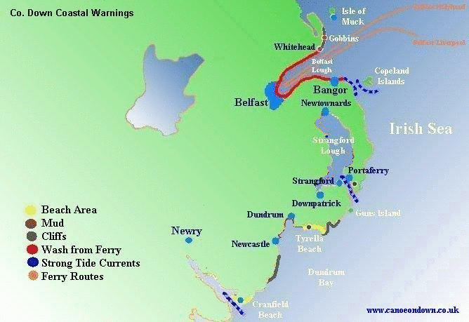
This map is only a guide and only indicates some of the main hazards in the area.Safety is the responsibility of the individual. Care should be taken wherever you Paddle.
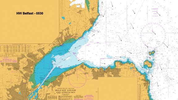
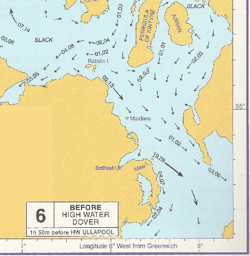
Tide Streams for Northern Ireland.